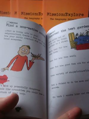
The Mission : Explore book is finally out in print and available from tomorrow.... Buy as many copies as you can !! Come and see us at the GA Conference
Posts
Showing posts from March, 2010
- Get link
- X
- Other Apps
Geographical Association and ESRI (UK) announce sponsorship agreement Leading organisations join forces to help schools introduce GIS into lessons 23 March 2010 - The Geographical Association (GA), the geography subject association, and ESRI (UK), the UK’s leading GIS software provider, today announce that ESRI (UK) has become the GA’s first corporate member and strategic partner. This new partnership brings together ESRI (UK)’s expertise in GIS (Geographical Information Systems) and the GA’s understanding of the learning and teaching of geography. With GIS now a compulsory part of the national curriculum, the organisations will combine forces to help teachers respond to the curriculum changes and introduce GIS into geography lessons. The signing of this first partnership agreement is a new departure for the GA. With funding in place for the next three years the GA can plan ahead, working with ESRI (UK) to introduce the power of GIS technology to schools as part of its mission of ...
- Get link
- X
- Other Apps
Thanks to those who came along to my lecture last night at Easton College, near Norwich. It was my Presidential lecture for the GA Norfolk branch , and a joint event with the Royal Geographical Society and thanks once again to the Stannards for their hospitality and organisation. The presentation I used is below, although you won't get the full story of course without the 50 minutes of me talking over it... Very flat, norfolk View more presentations from GeoBlogs . There were some interesting comments after the lecture with respect to the (inevitably) partial nature of the presentation: some areas of Norfolk were not featured to the degree that others would have expected, and perhaps reflects my own knowledge and experiences of the county. There was little mention of Broadland, and nothing on Breckland, although I passed through both within the last fortnight. Also some discussion on the political importance of place, and some of the potential future changes in Norfolk's land...
- Get link
- X
- Other Apps
Images copyright Google Google Street View has gone national A huge update of Google's photography means that over 90% of the UK is now covered by the high resolution, 360 degree imagery along most roads in the UK One of the first things that people would do perhaps would be to look at their own house, and the houses where they used to live.... Just done that myself, and you can see the house where I lived between 1977 and 1988 (ish) above, tho' it didn't look like that at the time... There was a useful post on Simon Haughton's blog which suggested some geographical ideas for how the newly expanded Street View could be used in the classroom. Here are some (more): 1. Previewing a journey that is going to be made / risk assessments for fieldwork 2. Carrying out VIRTUAL FIELDWORK in an unfamiliar area 3. Investigate change over time in a local area 4. Clone Town / Land use surveys 5. Remodelling the models: transects from town centre outwards to test their validity 6. C...
- Get link
- X
- Other Apps
The Mission Explore crew are going on the road this summer. You can catch us at the events listed above, with some others still to be added as we take the idea of Mission Explore to a range of audiences. Mission Explore is coming out soon in book form - I spent some time proof-reading the resources earlier, and they are looking cool. They can be pre-ordered for £6.... You can also help yourself to cool Mission Explore gear via our ONLINE SHOP. Busy times for the GEOGRAPHY COLLECTIVE I'll see you at GLASTONBURY - need to hunt out my loon pants....